Information portal about all European guided public transportation systems. This site is regularly updated.
Samara METRO (photo N.2/3 [KB 70] 800 x 533pixels)
   

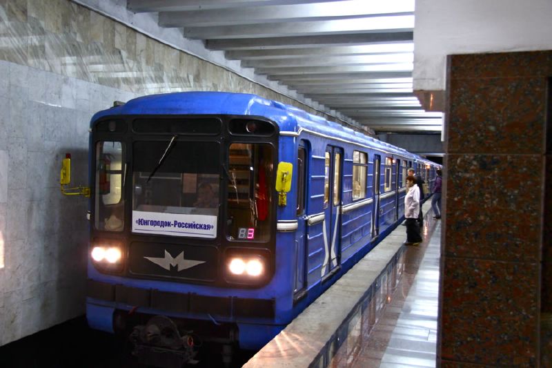
By Mikhail (Vokabre) Shcherbakov (Flickr: Moskovskaya (??????????)) [CC BY-SA 2.0 (http://creativecommons.org/licenses/by-sa/2.0)], via Wikimedia Commons


DESCRIPTION
Samara metro was planned in order to facilitate local displacements to/from the worksites located in Bezymyanka industrial district.
Its first section opened in 1987 (Yungodorok-Pobeda section) and it was slowly but constantly extended (despite USRR disgregation) in 1992, 1993, 2002, 2007 and 2015. Metro currently runs from Alabinskaya (west) to Yungorodok (east).
(last modified February 19, 2017 )
HISTORY
datesection nameline
26-12-1987Yungorodok-PobedaKuybyshev Metro
30-12-1992Pobeda-SovyetskayaKuybyshev Metro
25-03-1993Sovyetskaya-SportivnayaKuybyshev Metro
30-12-1993Sportivnaya-GagarinskayaKuybyshev Metro
27-12-2002Gagarinskaya-MoskovskayaKuybyshev Metro
26-12-2007Moskovskaya-RossiyskayaKuybyshev Metro
01-02-2015Rossiyskaya-AlabinskayaKuybyshev Metro
(last modified February 19, 2017 )
TECHNICAL DATA
Single line length (Km)
--
Single line stops
--
Single line avg. distance (km)
--
Total track length (km)
12.7
Total network stops
10
Avg. stop net distance (km)
1.4
Type
steel wheels
Current/Voltage
825 V DC by third rail
Type of guide/gauge
1524 mm gauge rails
Vehicles builder
VAGONMASH
Model
81-717/714,81-717.5/714.5
Operator
SAMARA METRO
(last modified February 19, 2017 )
this map is shown here at its maximum resolution (800 x 380)


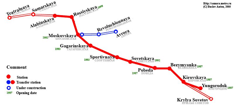
metro - samara; By Wikipedia.org (see Samara Metro page)
report an error

search a city

LATEST UPDATES TO THIS SITE
apm19-02-2017
lrt-tram27-06-2018
metro26-06-2018
funicular20-02-2017
news20-02-2017


METRO Samara PHOTO
pictures found on server: 3
click on a picture to enlarge it
Total size of this site MB 268